|
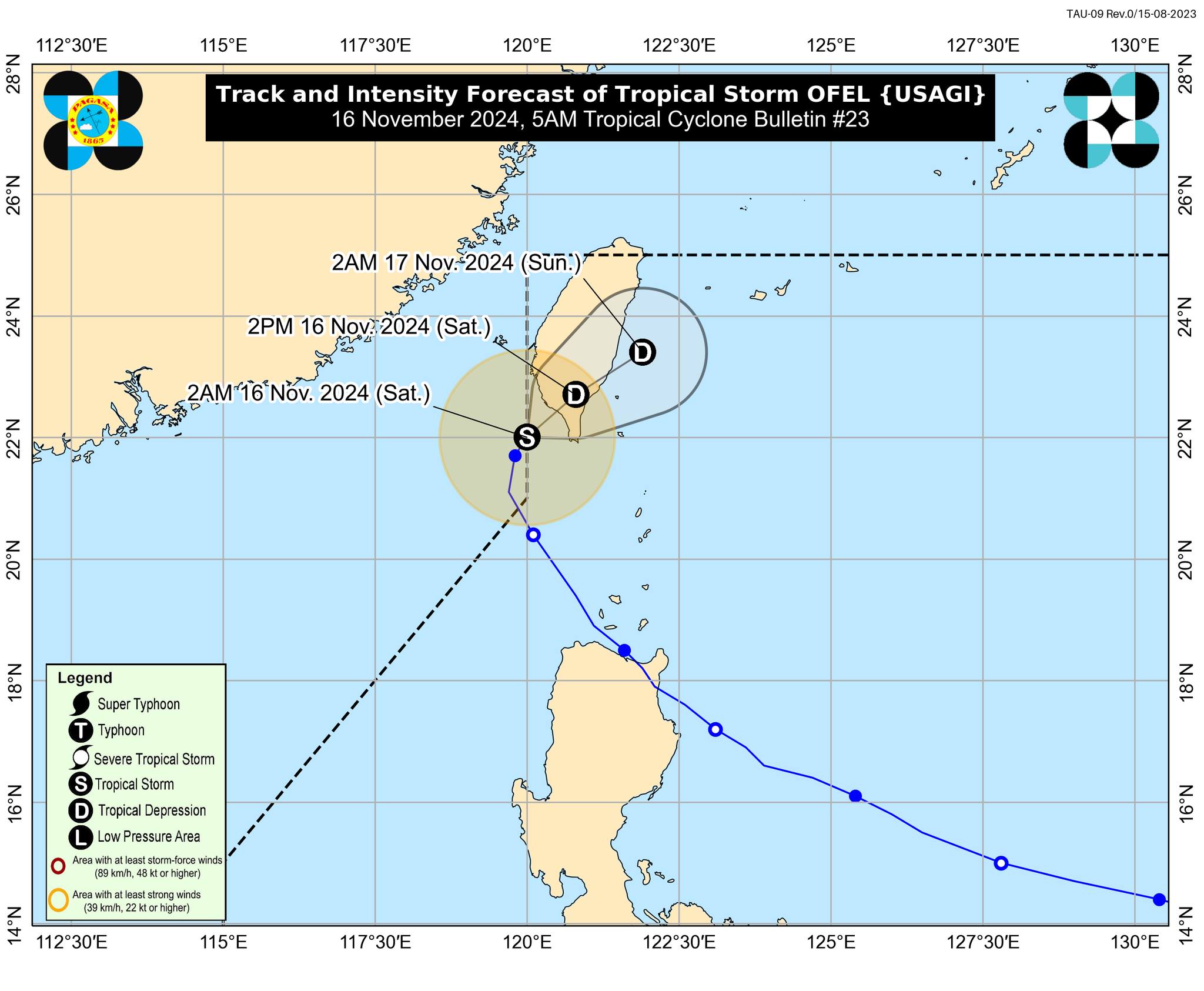
SUPER TYPHOON OFEL’S WRATH Government rehabilitation teams begin the clearing operations and urgent repairs on Friday, November 15, 2024, after a critical section of the main bridge in San Jose village, linking the towns of Gonzaga and Santa Ana in Cagayan, collapsed following the impact of Super Typhoon Ofel that struck the province this week. PHOTO FROM TASK FORCE LINGKOD CAGAYAN-QUICK RESPONSE TEAM MANILA, Philippines — Tropical Storm Ofel (international name: Usagi) remained inside the Philippine area of responsibility (PAR) early Saturday morning following its re-entry the night before. However, the Philippine Atmospheric, Geophysical and Astronomical Services Administration (Pagasa) said it would further reduce its strength as it moves toward Taiwan, whose mountainous terrain will make the atmosphere unfavorable for Ofel. Article continues after this advertisementPagas said Ofel will likely diminish into a “remnant low” by Sunday, November 17, or even earlier. FEATURED STORIES NEWSINFO Super Typhoon Pepito now approaching landfall in Catanduanes NEWSINFO LIST: Areas at high risk of storm surge due to Super Typhoon Pepito NEWSINFO Pepito makes landfall in CatanduanesBased on the 5 a.m. cyclone bulletin of Pagasa, Ofel was last spotted 240 kilometers northwest of Itbayat, Batanes, packing maximum sustained winds of 75 kilometers per hour (kph) near the center and gustiness of up to 90 kph. It was slowly moving north-northeast, it added. Article continues after this advertisementREAD: Weakened Ofel re-enters PAR Article continues after this advertisementIn the 11 p.m. cyclone bulletin of Pagasa, the storm was carrying maximum sustained winds of 85 kph and gustiness of 105 kph when it reentered the PAR. Article continues after this advertisement“Ofel is forecast to further weaken due to the increasingly unfavorable environment and interaction with the mountainous terrain of Taiwan, possibly downgrading into a remnant low tomorrow or earlier,” the state weather agency said. Tropical Storm Ofel is seen to move northeastward this Saturday, passing through southern Taiwan and emerging over the sea east of Taiwan by early Sunday morning. 

Tropical Storm Ofel (international name: Usagi) track and intensity, 5 a.m., Saturday, November 16, 2024. – The tropical storm remained inside the Philippine area of responsibility (PAR) early Saturday morning following its re-entry the night before. Photo from Pagasa Subscribe to our daily newsletter |

